Visual decoder METAR & TAF
Best Metar-Taf Images and Marketing Description
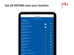
Visualized METAR and TAF weather information for all airports in the world. Concise summary of everything you need to know about today's aviation weather.
METAR features:
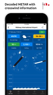
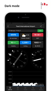
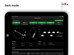
- Visualized in easy to understand and colourful metrics
- Weather symbols for significant weather and clouds, like in a non-aviation weather report
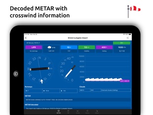
- Crosswind calculations, by combining METAR and runway information
- Flight rules category: VFR, MVFR, IFR, LIFR
- Read out by text-to-speech available, listen to a decoded METAR while doing other things
TAF features:
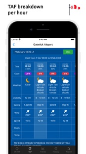
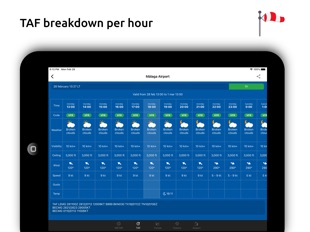
- TAF broken down and displayed per hour in a table
- Show sunrise/sunset, minimum and maximum temperature
Keeping track:
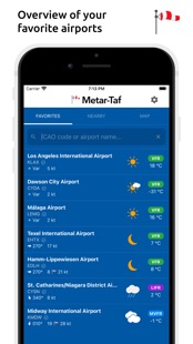
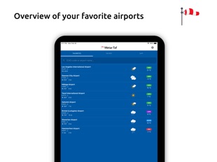
- Add your favorite stations to the list, see their weather at a glance
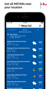
- Get observations near your location
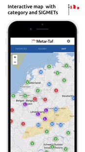
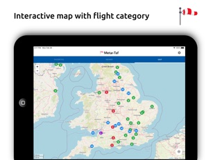
- Find stations in the interactive map with weather codes
- Search airports by ICAO code or name
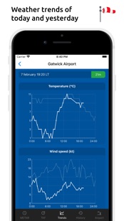
History:
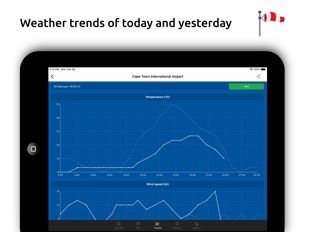
- Graphs with weather trends today and yesterday: temperature, visibility, wind speed, QNH
- METAR history for the last hours and link to more on the website
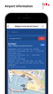
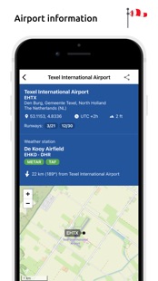
Airport information:
- See information about the airports, like runway directions, elevation, location
- If the airport doesn't report a METAR, the nearest station used for calculations
Calculations:
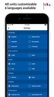
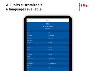
- All units are customizable units: speed (knots, km/h, m/s, mph), altitude (meters/feet), visibility (kilometers/miles), temperature (Celcius/Fahrenheit) and air pressure (Hectopascal, Inch Hg)
- Times are converted to the local time for each airport
- Sunrise and sunset are calculated based on the airports latitude/longitude
General:
- METAR, TAF and airport data are automatically saved for offline use
- Available in 6 languages: English, Dutch, Spanish, Portuguese, German and French
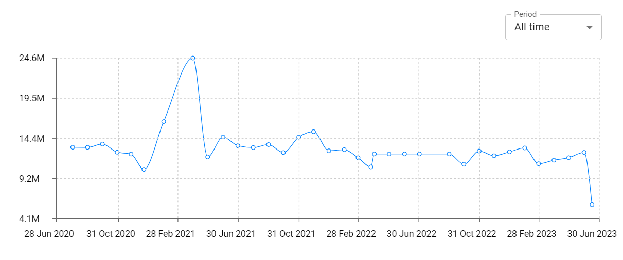
Metar-Taf Revenue and Downloads
Measure Metar-Taf performance and get insights with AppstoreSpy data you won’t find anywhere else using our Analytics, Revenue Stats ans Trends.
Metar-Taf Global Top Charts: Interactive Map of Country and Category Rankings
Metar-Taf Revenue and Installs Distribution by Countries
Metar-Taf Changelog