USGS River Levels & Flows
Best River Levels & Flows Images and Marketing Description


Main Features Include:
+ USGS / AHPS River Levels & Flows
+ Gauge Flood Status Push Notifications
+ Weather Prediction Center Charts
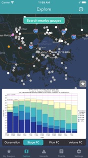
Interactive USGS / AHPS Gauge Map
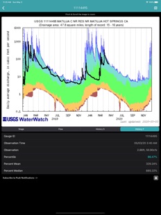
The USGS maintains a national network of stream gauges that provide hydrological observations. In addition, AHPS collects real-time water level information from other federal, state, and local stream gauge networks.
USGS / AHPS Hydrological Data Includes:
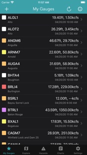
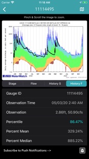
+ Water Level & Flow Observations
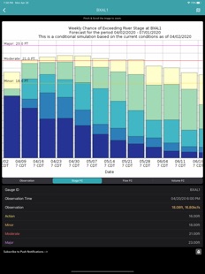
+ Gauge Levels, Flows & Volume Forecast
+ Gauge History & Statistics
+ Flood Status Push Notifications
Weather Prediction Center Charts
+ Significant River Flood Outlook
+ Quantitative Precipitation Forecasts
+ Excessive Rainfall Outlook
+ U.S Hazards Outlook
+ Risk of Heavy Precipitation
Enjoy!
River Levels & Flows Revenue and Downloads
Measure River Levels & Flows performance and get insights with AppstoreSpy data you won’t find anywhere else using our Analytics, Revenue Stats ans Trends.
River Levels & Flows Global Top Charts: Interactive Map of Country and Category Rankings
River Levels & Flows Revenue and Installs Distribution by Countries
River Levels & Flows Changelog